

TruFlite Gallery
Here's what TruFlite can achieve. An asterisk indicates that the source data used are publicly available on the WWW.
Also have a look at TruFlite related Wikimedia Commons entries.
Files larger than 1 MB are marked bold.
 |
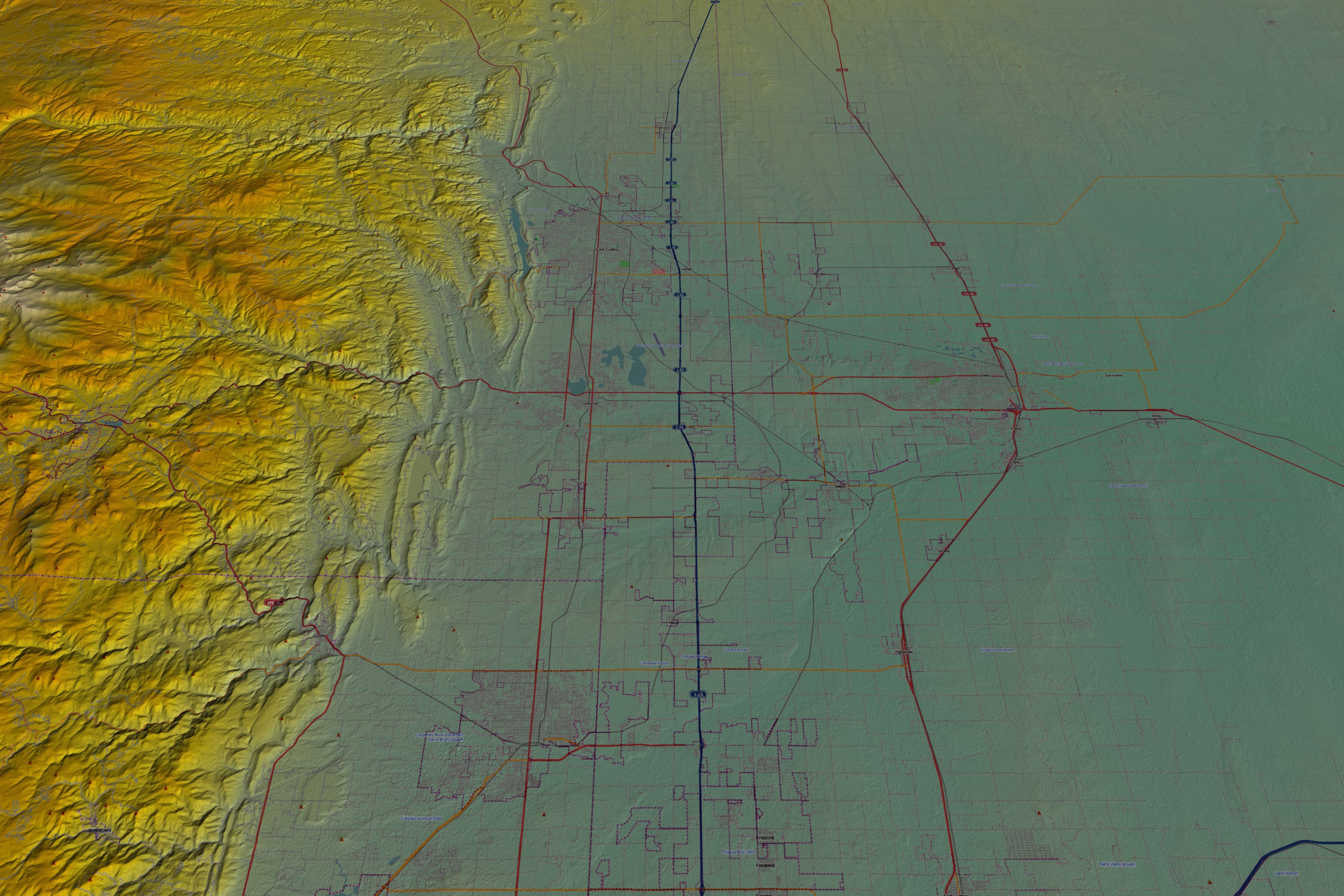
Loveland, CO*. A new texture source was used for this image of Brenton White's home town: OpenStreetMap.org. Available image sizes: 7200 by 4800 pixel (4.48
MB) |
||||||
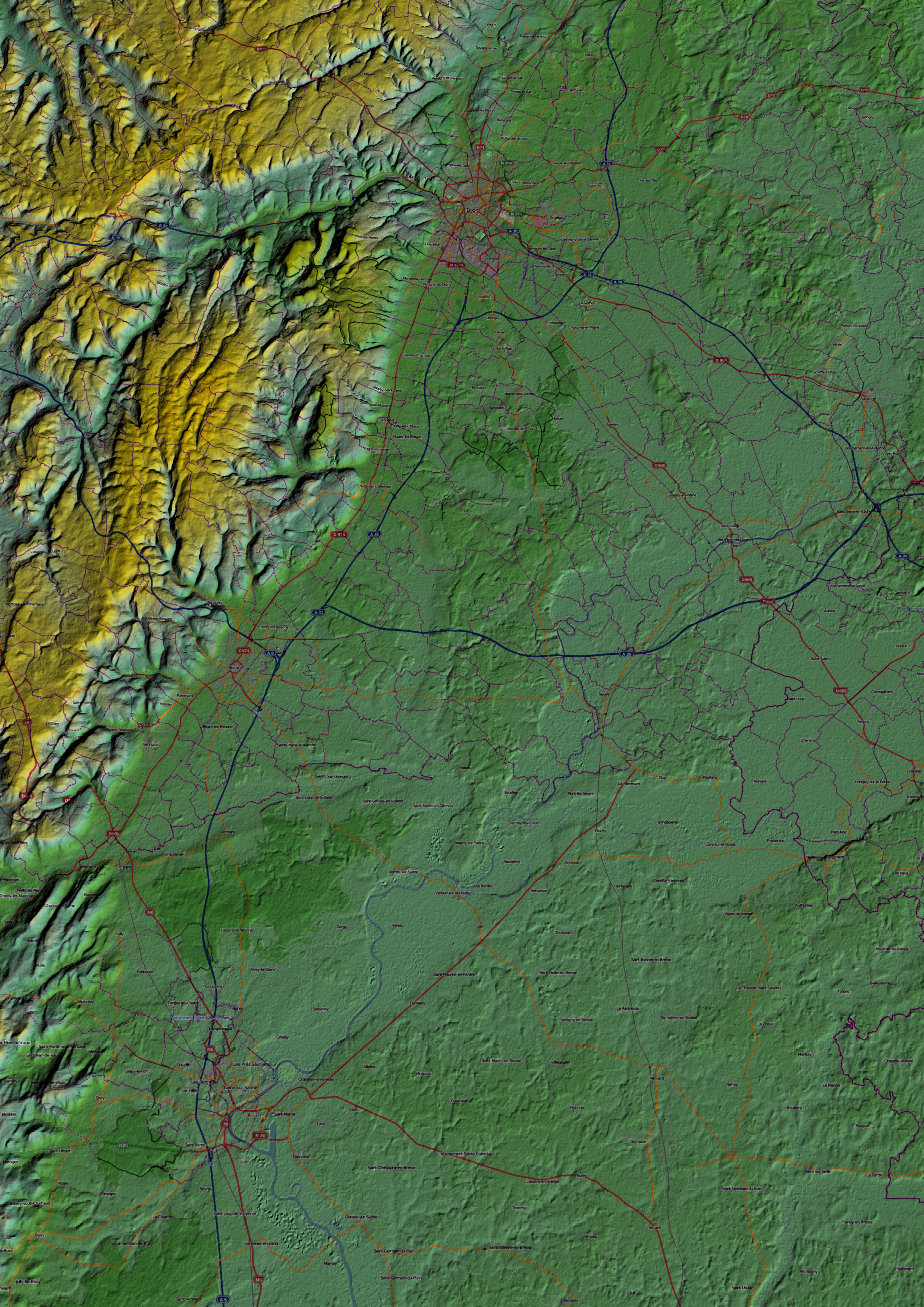 |
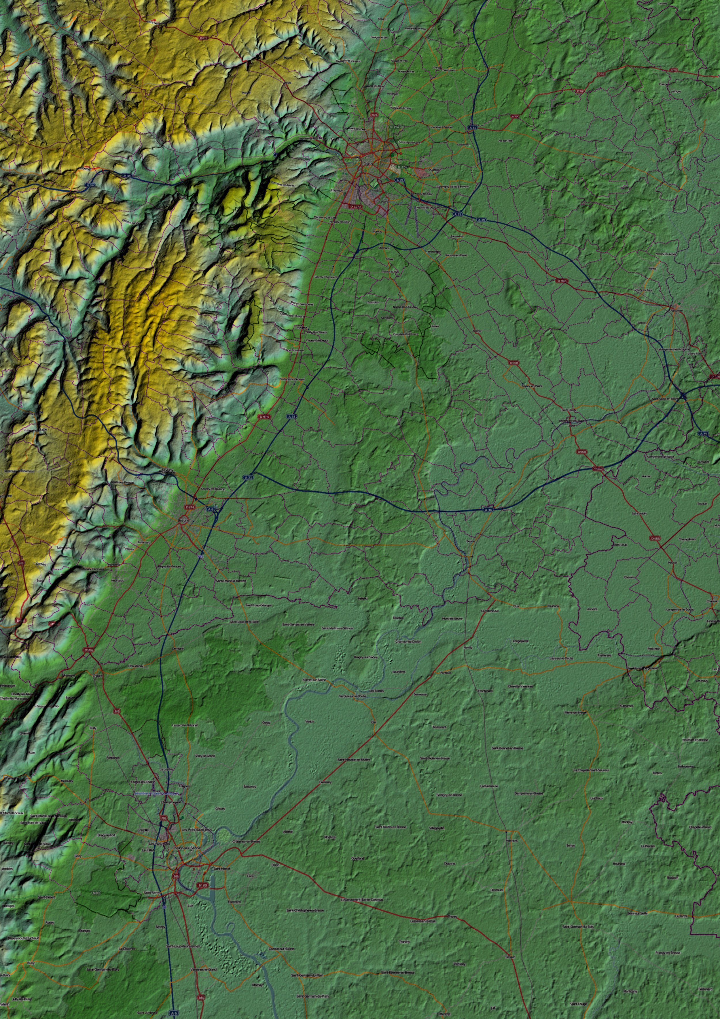
Dijon, France*. Also produced using texture data from OpenStreetMap.org. Available image sizes: 5000 by 7071 pixel (5.02 MB) |
||||||
 |
Port Angeles, WA*. This small sample was created using three mouse clicks and the new geocoding tool geoDataClient. All you need is to know is the mailing address of the place! |
||||||
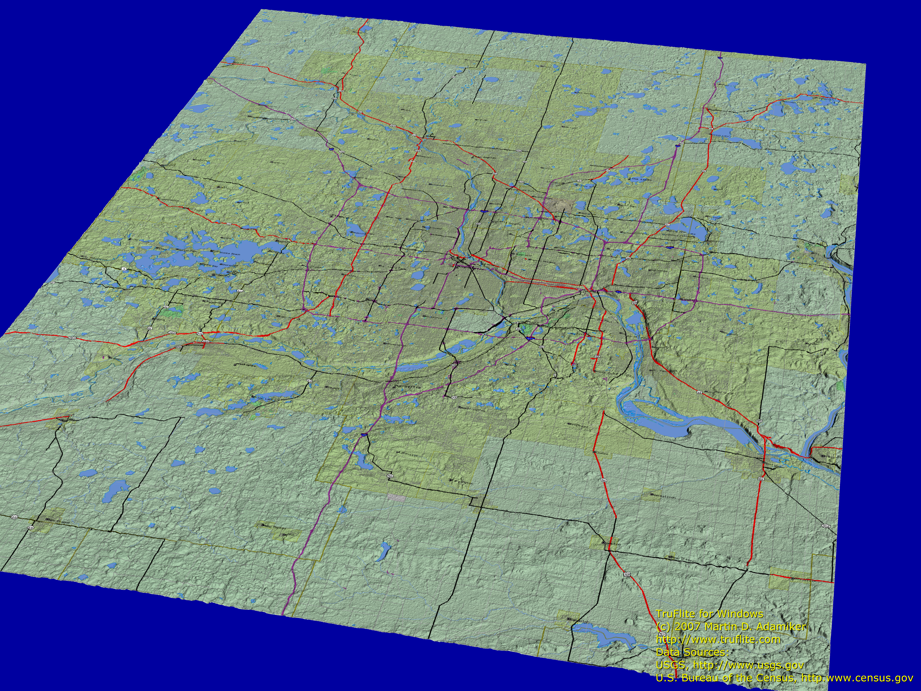 |
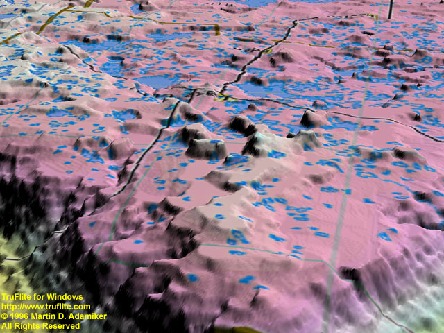
Minneapolis, MN*. Data from USGS (Shuttle Radar Topography Mission SRTM) and U.S. Bureau of the Census. |
||||||
 |
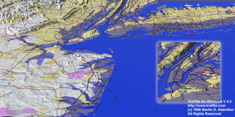
New Jersey and New York, Lower Bay*. Data from USGS (Shuttle Radar Topography Mission SRTM) and U.S. Bureau of the Census. |
||||||
 |
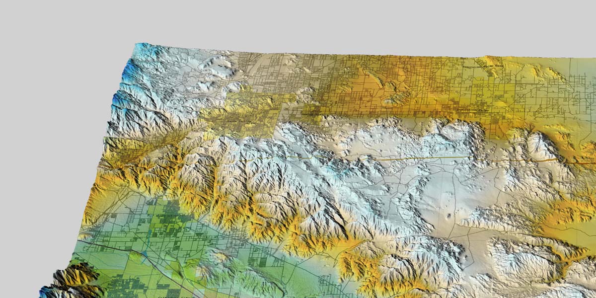
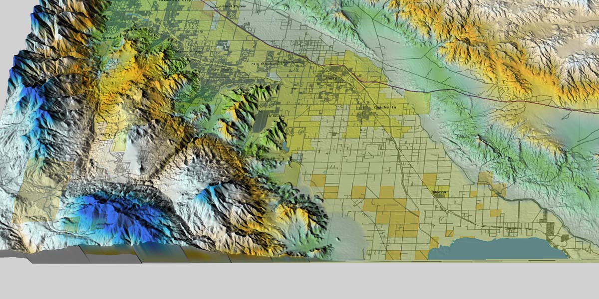
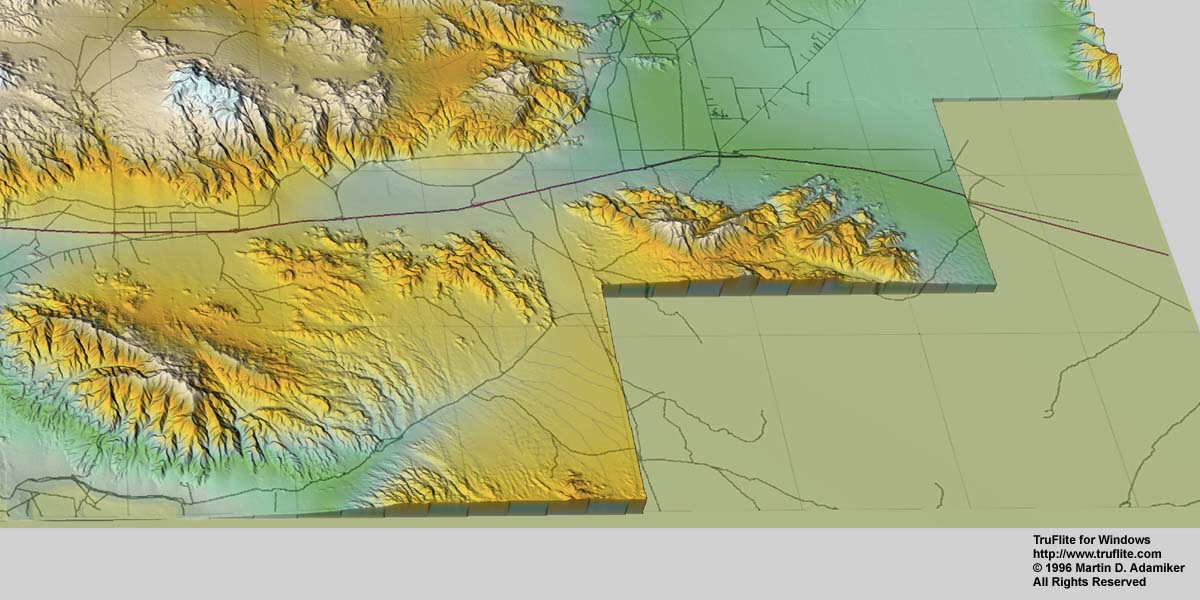
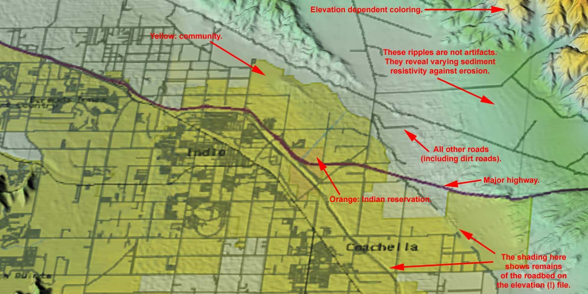
Joshua Tree National Park, California*. A 55 MB video of a flyover. |
||||||
|
Joshua Tree National Park, California*. Four quarters of a 2400 by 1200 pixel image: upper left, upper right,lower left, lower right quarter. | ||||||
|
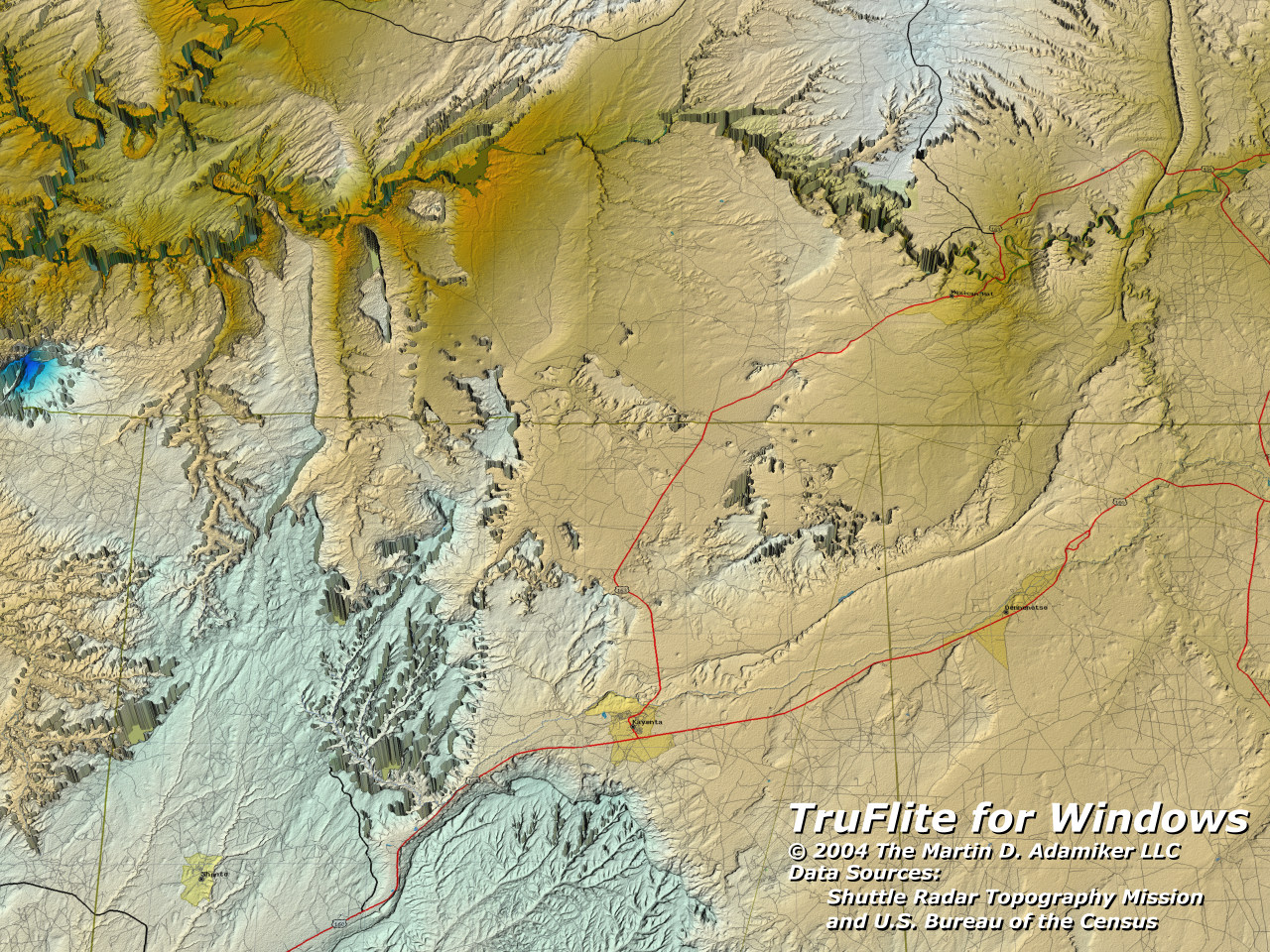
Monument Valley*, made using Shuttle Radar Topography Mission data.
The data are "unfinished" data, i. e. containing zero values
where no radar echo was retrieved, or values too low where the echo
came in delayed.
This image will be updated soon, using the finished data set available on DVD from the EROS Data Center; see http://srtm.usgs.gov. Elevation data: NASA/USGS |
||||||
|
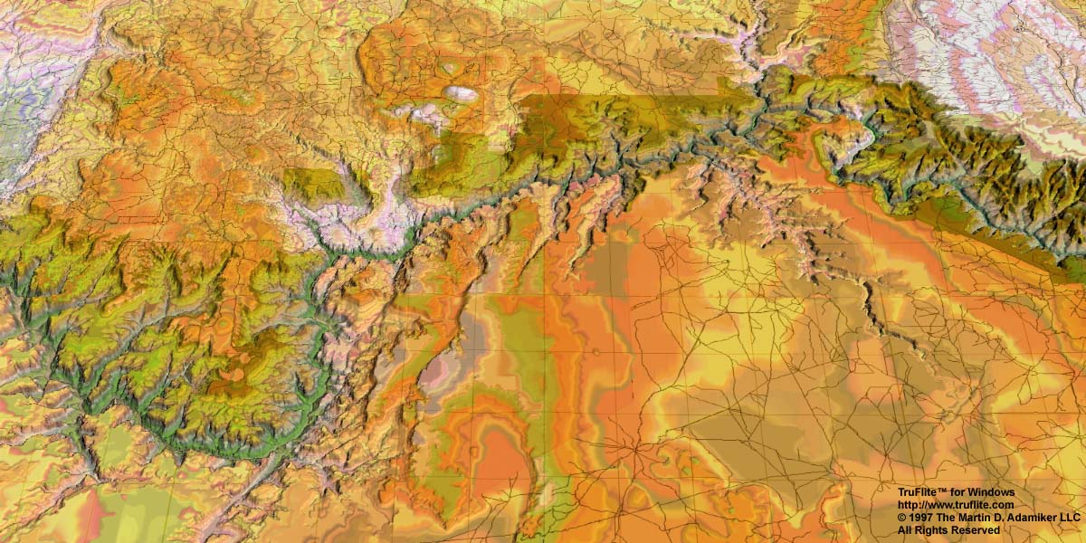
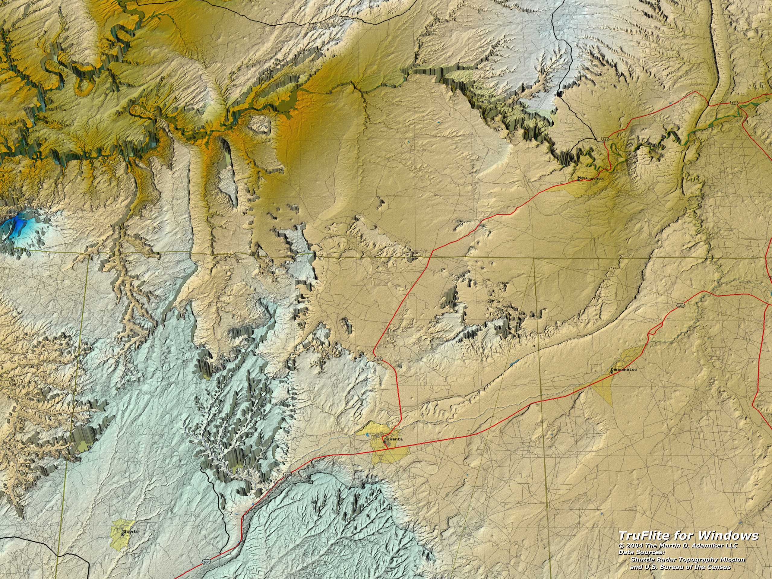
The central section of Monument Valley*, made using NED 1/3 arc
second data.
The horizontal brown line is the Arizona-Utah state border; the red line is the Highway 163, between Mexican Hat and Kayenta. The high resolution of the rendering (30 million polygons) reveals the vertical data resolution of the source data - the faint steps. Elevation data: USGS Seamless The dataset ready for TruFlite to render this image is available as a ZIP file: MonumentValley.zip The original NED dataset: 79106447.ZIP |
||||||
|
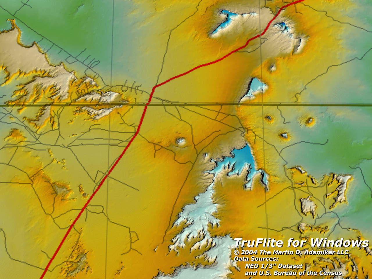
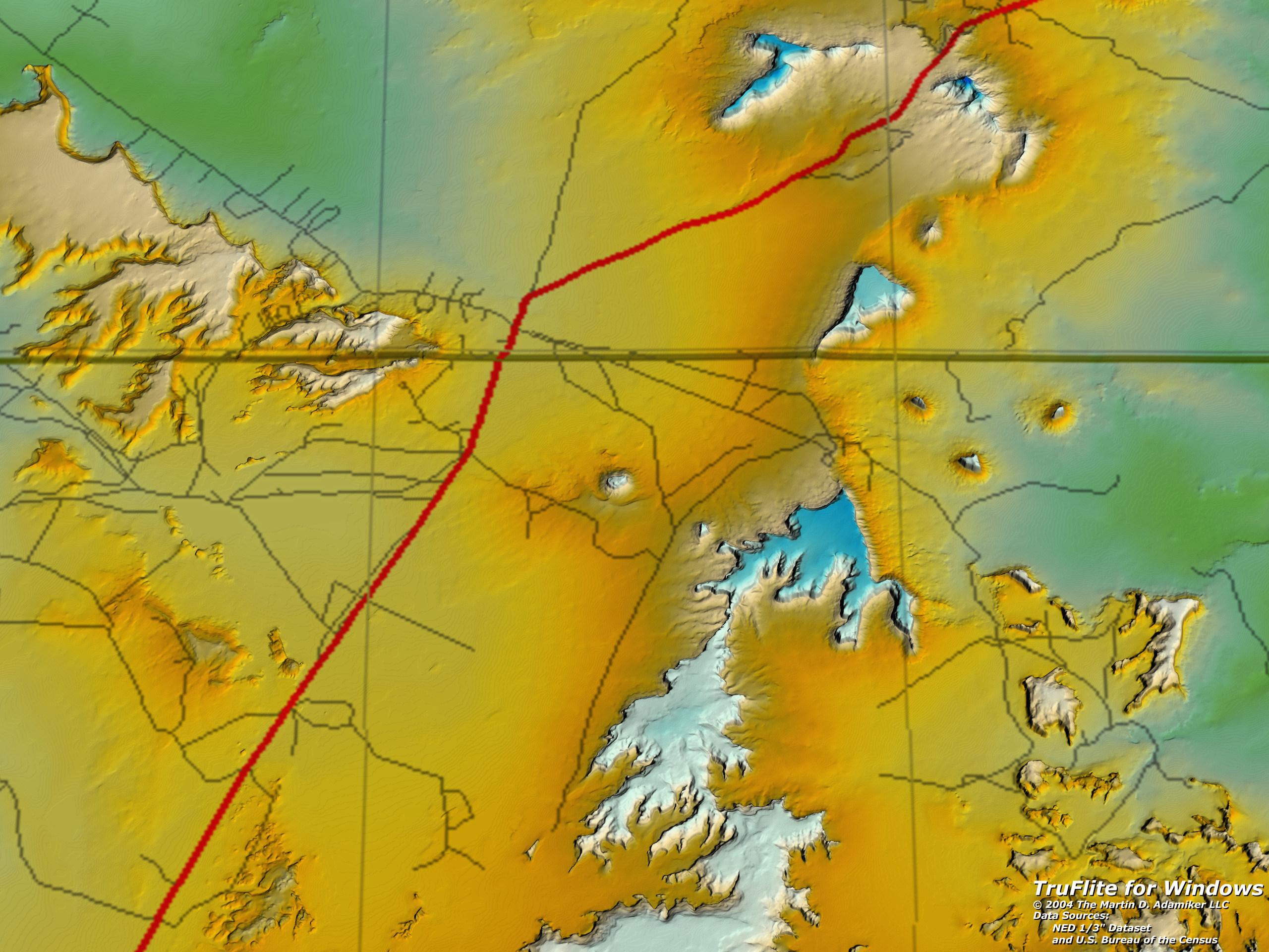
Monument Valley*, made using NED 1/3 arc second data.
The camera was placed above the highway 163. Viewing direction, 150° (southeast). Elevation data: USGS Seamless The dataset ready for TruFlite to render this image is available as a ZIP file: MonumentValley.zip The original NED dataset: 79106447.ZIP |
||||||
|
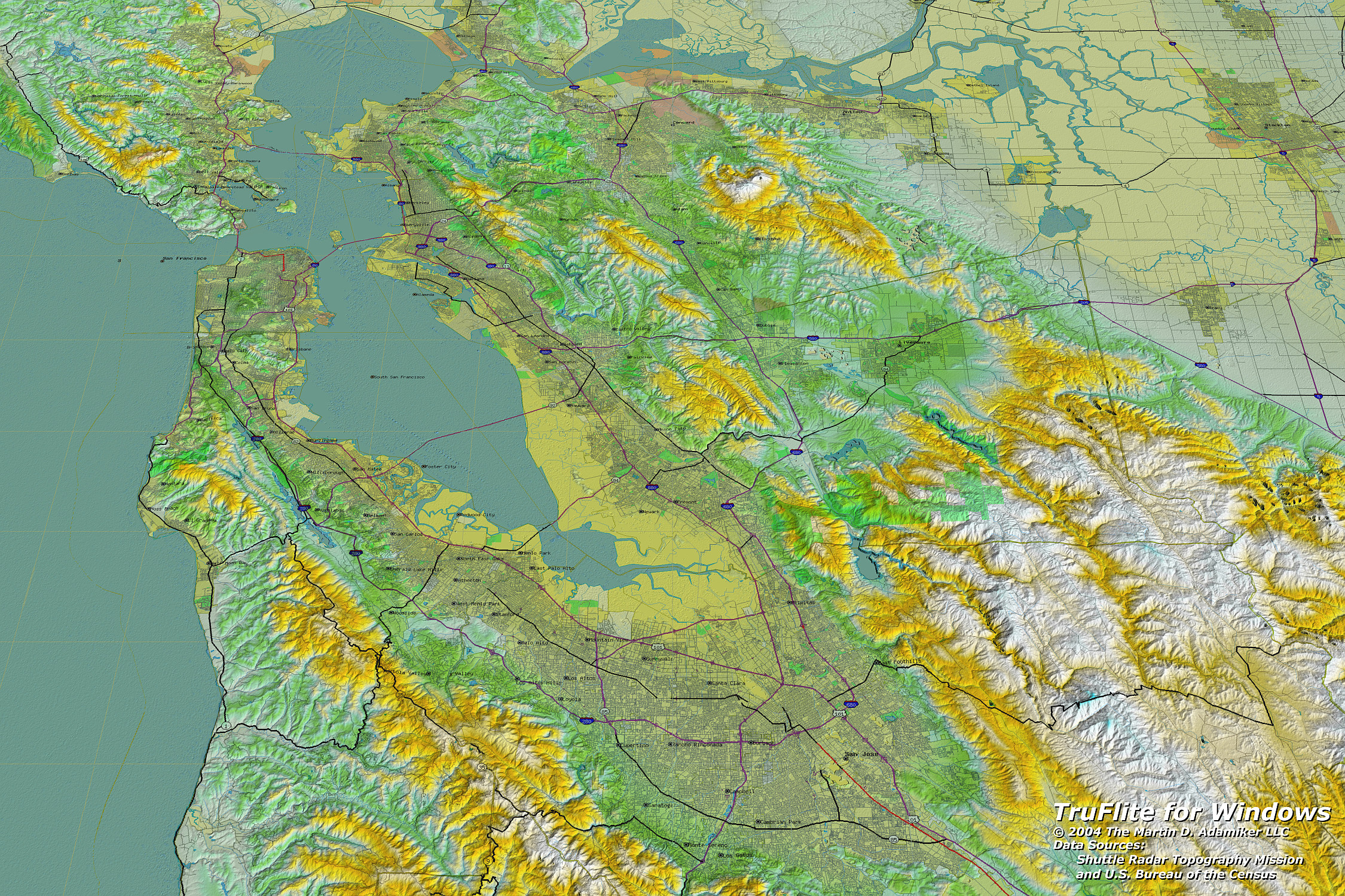
Silicon Valley and the San Francisco Bay Area*, made using Shuttle Radar Topography Mission data.
The data are "unfinished" data, i. e. containing zero values
where no radar echo was retrieved, or values too low where the echo
came in delayed.
Elevation data: NASA/USGS |
||||||
|
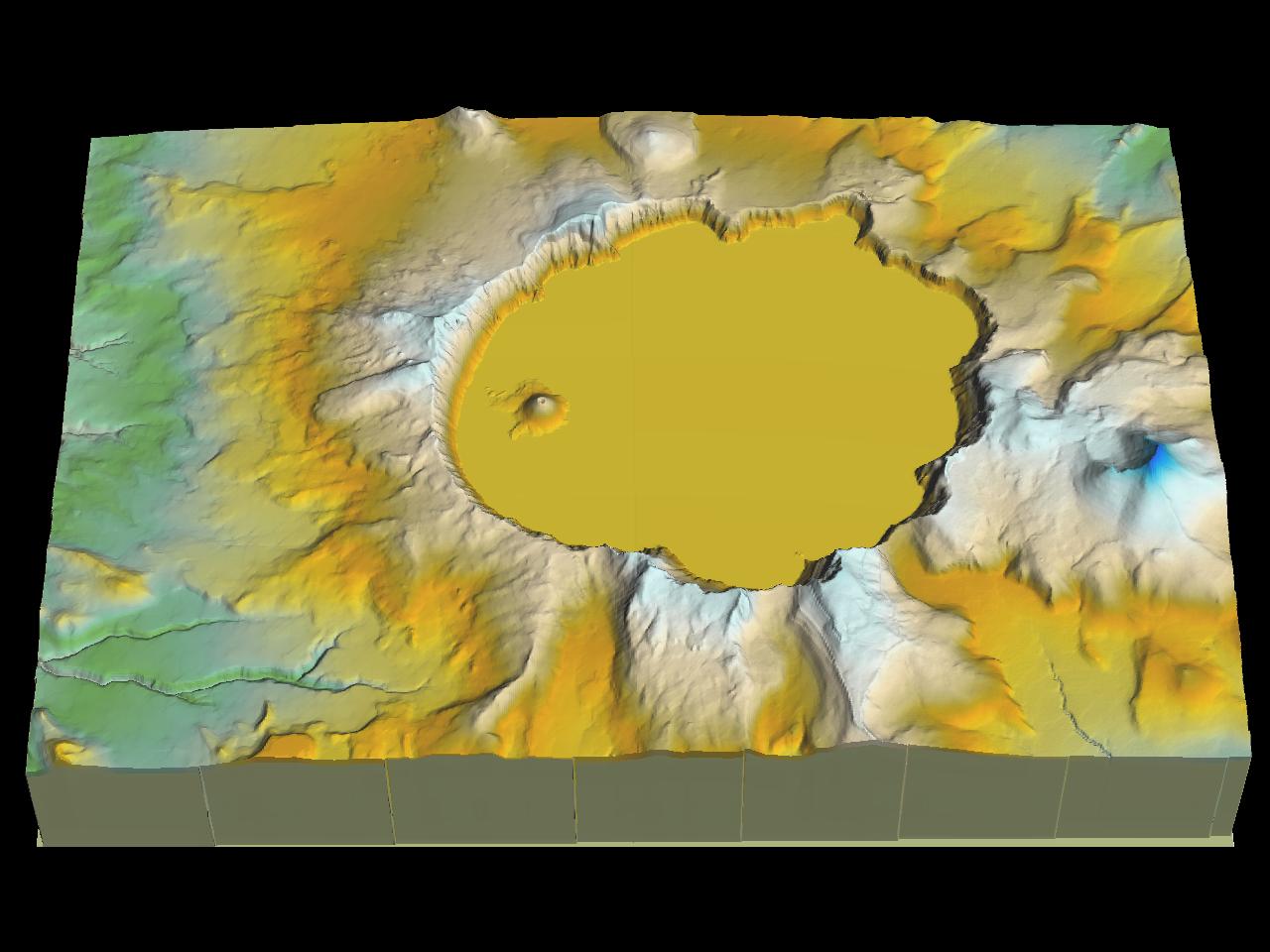
This Crater Lake, OR image* demonstrates the use of SDTS data. To see how it was created, see our SDTS tutorial. | ||||||
|
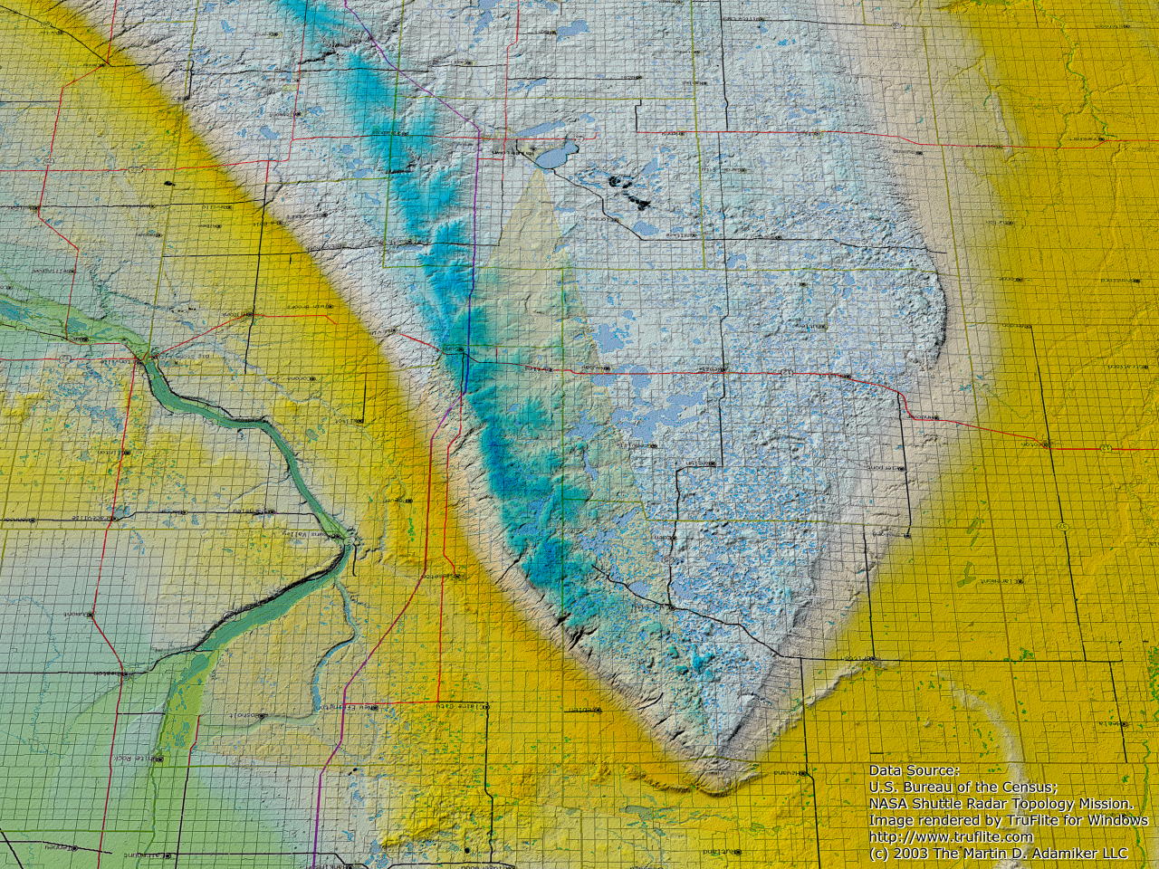
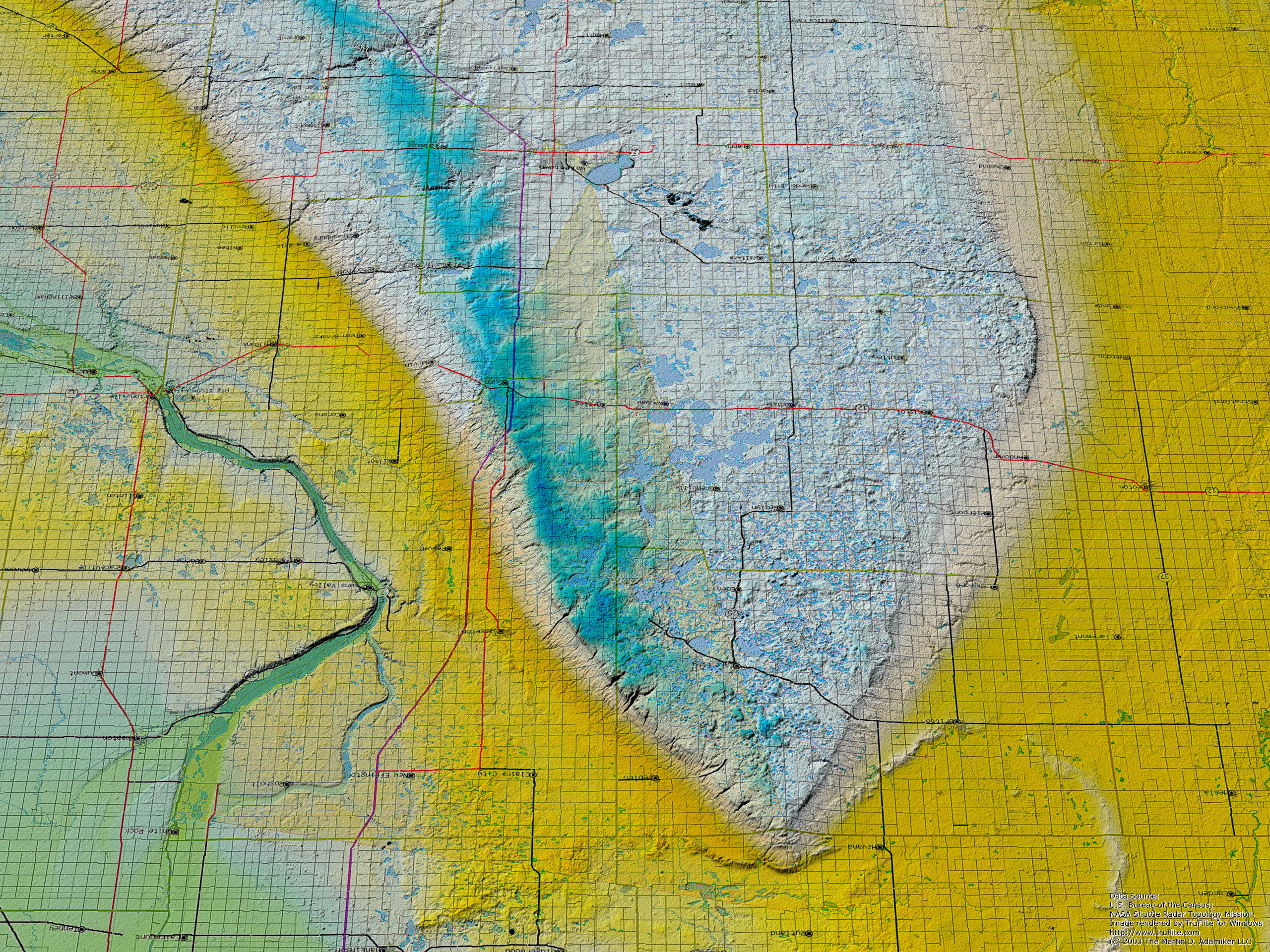
The Prairie Coteau view* from below, created in September 1997 using 3 arc second DEM data, was redone using SRTM data. The text on the surface is displayed upside down - we are viewing southwards. Elevation data: NASA/USGS |
||||||
|
The Prairie Coteau* (Coteau des Prairies) in South Dakota, viewed from the north. Vertical exaggeration factor: 20. The fine terraces reveal the vertical DEM resolution: 1 meter. At the western rim you can see real erosion patterns, however. Detail of the plateau near Lake City. This image inspired by Donald P. Schwert, North Dakota State University and Ray Sterner, Johns Hopkins University. | ||||||
 |
The neighborhood of Milwaukee, WI*. | ||||||
 |
MPEG-I animation* of a flight over the Rio Grande near Albuquerque, NM (9.23 MB). Also on the CD. | ||||||
 |
MPEG-I animation* of a flight over Monument Valley (9.22 MB). Also on the CD. | ||||||
 |
MPEG-I animation* of a flight into Grand Canyon near Mather Point and out again (1.2 MB). | ||||||
 |
Grand Canyon*, spacecraft view. Elevation data: USGS. Texture data: Silicon Mapping Solutions. | ||||||
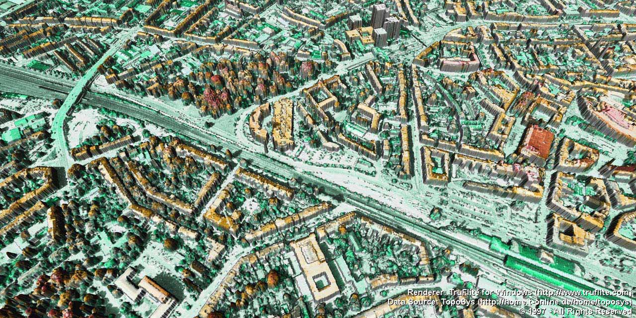 |
A view of the city of Bonn, Germany. The elevation data aquisition was made through laser scanning by TopoSys GmbH, Ravensburg, Germany. The texture is a blend of an orthophoto and TruFlite's elevation-to-color process. | ||||||
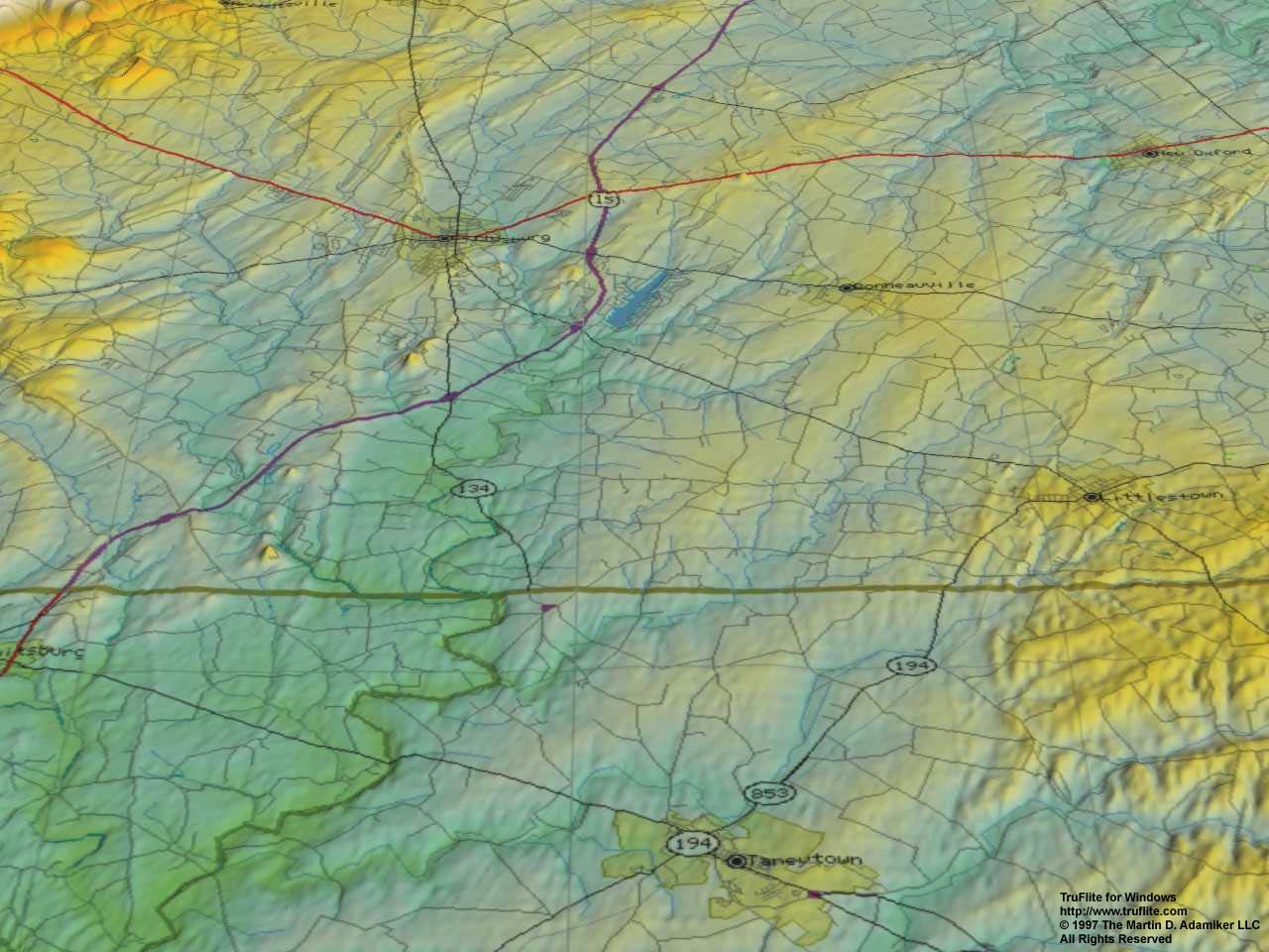 |
The vicinity of Gettysburg, PA*. | ||||||
 |
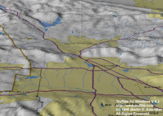
A view of the region* where NASA's Mars Pathfinder landed. The approximate landing site is where the yellow lines intersect. Elevation data: Viking Orbiter's Global Topography dataset. Texture data: Mars Explorer. | ||||||
|
Spacecraft view of Pakistan* and the Karakoram Range* as seen from 60000ft. The texture data come from TruFlite itself (elevation-to-color conversion) and from the Xerox PARC MapWeb Server (now discontinued). Vertical exaggeration 2.8. | ||||||
|
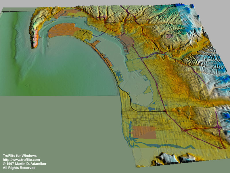
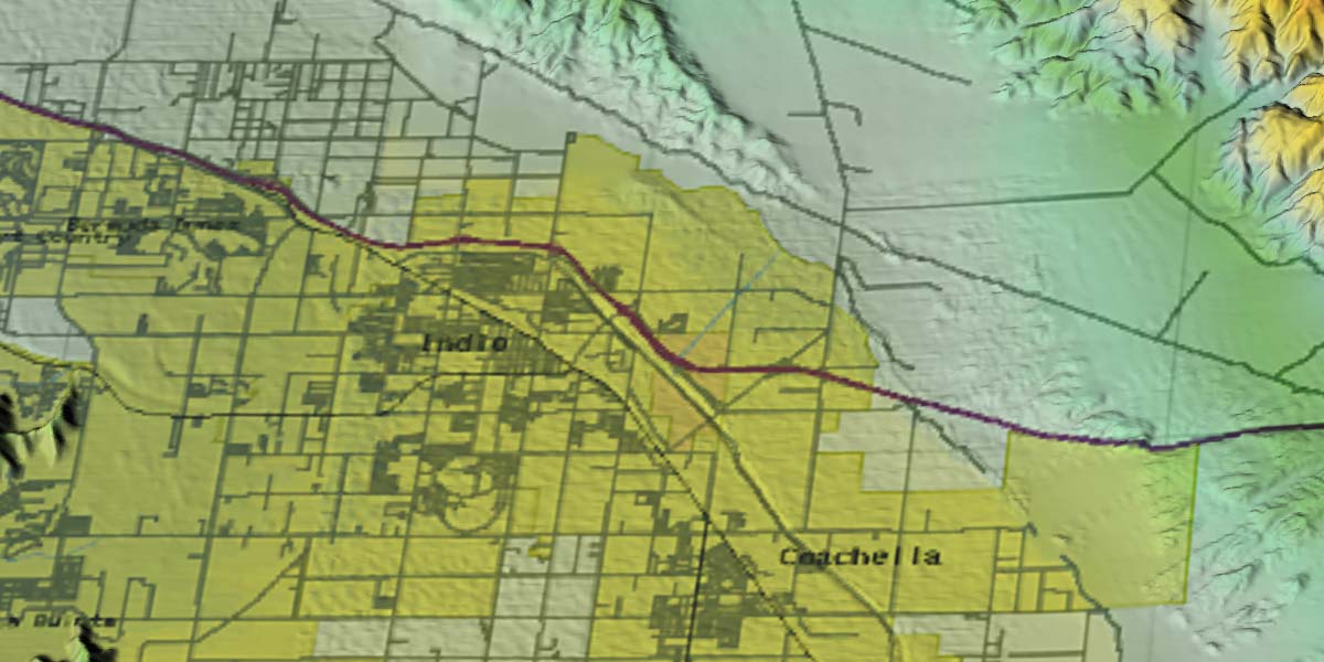
San Diego Bay bathymetry data* from the San Diego Bay Project data inventory of the San Diego Supercomputer Center. We combined these data with 30 meter DEM data from the U.S. Geological Survey (see our DEM guide) and some texture from the U.S. Bureau of the Census Tiger Mapping Service. Some steps in the process were done manually - we intend to automate this in a future TruFlite version. | ||||||
|
A detail of the above image cropped from the original 4000 by 2000 pixel output file. Information on features in the image. | ||||||
 |
Hawaii* from the South. A mosaic of 5 U.S. Geological Survey DEMs (1 square degree coverage, 1200 by 1200 pixels each) was used as the elevation data source. | ||||||
 |
The production process for this image of Los Angeles* is described at the Workshop page. | ||||||
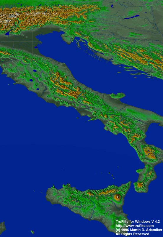 |
Italy and the Alps* as seen from 500 miles above. The texture data come from TruFlite itself (elevation-to-color conversion) and from the Xerox PARC MapWeb Server (now discontinued). | ||||||
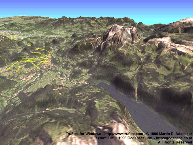 |
The vicinity of the city of Salzburg, Austria. The texture is a LANDSAT image (copyright Geospace, Inc., Salzburg, Austria). | ||||||
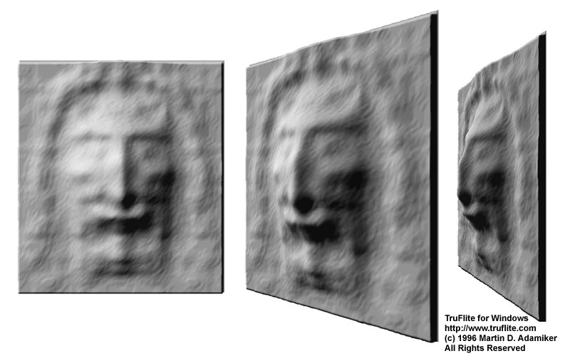 |
The head section of the famous Turin Shroud. Many people believe it is a picture of Jesus Christ. This image does not contain texture information. | ||||||
 |
New York City* 20 meters (60 feet) under water. This image was accomplished using a special TruFlite elevation-to-color palette. |


An asterisk indicates that the source data used are publicly available on the WWW.