
TruFlite - SDTS
SDTS Support
SDTS stands for "Spatial Data Transfer Standard". It is based on the ISO 8211 standard. For more information, see the USGS homepage on the subject: "http://mcmcweb.er.usgs.gov/sdts"
Since V 5.5, TruFlite has supported SDTS raster files. TruFlite V 5.9 provides enhanced SDTS import features: You may now import SDTS files in whatever units you like.
One "SDTS transfer" (one dataset) consists of a couple of files, some containing data and some containing descriptions.
For SDTS import into TruFlite, use the "????catd.ddf" files.
Example
Import the SDTS files covering Crater Lake, OR.
Download
The original datasets are located in: ftp://sdts.er.usgs.gov/pub/sdts/datasets/raster/dem/dem_1997/
| Western part:
The elevation unit of the file set is feet. |
Eastern part:
The elevation unit of the file set is meters. |
From the .tar.gz files, extract all files: 1281CATD.DDF, 1281CATS.DDF, 1281CEL0.DDF, ...
Import
In TruFlite for Windows, select "Calculate/Import Filters/SDTS..."
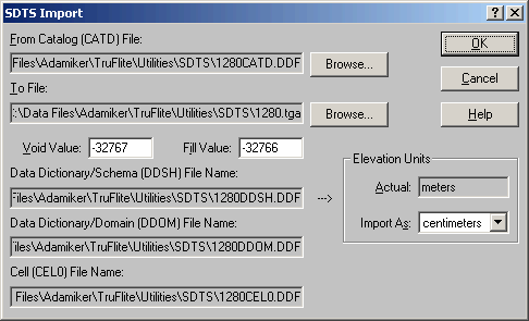 |
The "Import As: centimeters" option will convert the units from meters to centimeters. |
To select the "From Catalog (CATD) File", click the "Browse..." button.
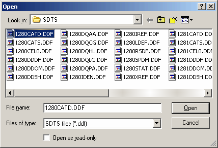 |
Always select the CATD (Catalog/Directory) file when importing. |
The "To File" is the output file, a regular TruFlite compatible elevation file.
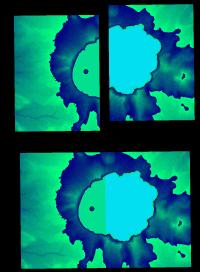 |
The two resulting TGA files,
|
The two resulting TGA file have to be stitched together by means of a graphics editor.
Use the magic wand tool to select the black (zero elevation) border. Color tolerance (a.k.a. threshold): zero. Antialiasing: no. Invert the selection. Copy/paste this into the other file.
Why does the eastern part of the lake surface have a different color?
The two source files are off in elevation about three feet. As our new elevation unit is centimeters (cm), we have a difference of 95 cm. The elevation is coded RED/GREEN/BLUE with the BLUE part the most significant byte.
Rendering
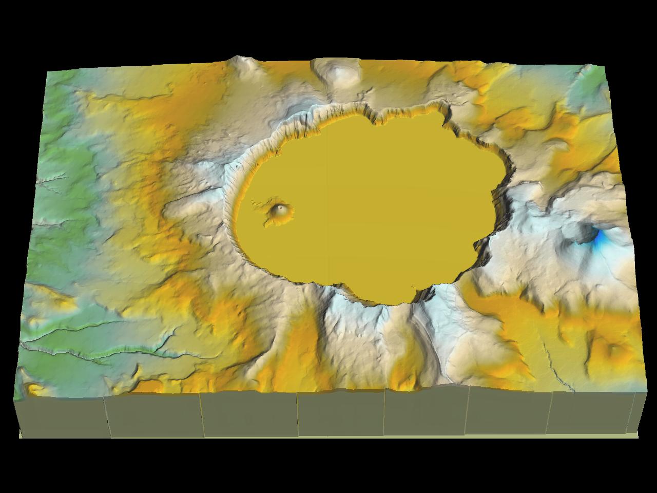 |
To see a bigger image, click on the above image |
A Closer Look Into SDTS
You may use the following program to investigate the contents of SDTS file sets. We compiled the public domain sourcecode of the STDS++ package from "http://mcmcweb.er.usgs.gov/sdts/sdtsxx/index.html".
| 32-bit program from SDTS++ (Courtesy USGS) |
|---|
| sio_Reader_t.zip (155 kB) |
Typical usage:
sio_reader_t.exe -v -i ????CATD.DDF | more
Note for users of Windows95:
sio_reader_t.exe needs the Winsock 2 runtime library. This library was not a basic Windows95 component. You'll find the Windows Socket 2 update on Microsoft's "Windows95 Updates" page: "http://www.microsoft.com/windows95/downloads/default.asp"
If you encounter problems downloading the files or have any questions, contact webmaster@truflite.com.